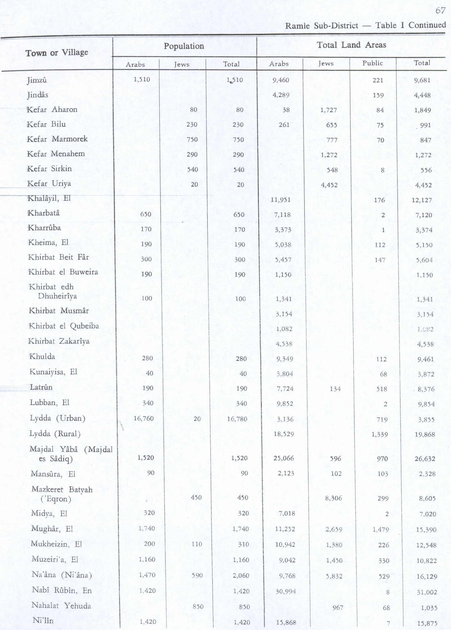
ENSIKLOPEDIA Cari Tekan Enter untuk memulai pencarian cepat. Kembali ke Ensiklopedia Arsip Wikipedia Indonesia Khirbat al-Buwayra Khirbat al-BuwayraDesa in Ramle, Mandat PalestinaTemplat:SHORTDESC:Desa in Ramle, Mandat PalestinaKhirbat al-Buwayra خربة البويرةDesaEtimologi: lubang kecil[1]Khirbat al-BuwayraKoordinat: 31°52′27″N 35°00′52″E / 31.87417°N 35.01444°E / 31.87417; 35.01444Grid Palestina151/142Entitas geopolitikMandat PalestinaSubdistrikRamleTanggal pengosongan15 Juli 1948Populasi (1945) • Total190[2][3] Khirbat al-Buwayra adalah sebuah desa Arab Palestina di Subdistrik Ramle. Desa tersebut dikosongkan saat Perang Arab-Israel 1948 pada 15 Juli 1948 dalam fase kedua Operasi Dani. Desa tersebut berjarak 15 km dari tenggara Ramla. Referensi ↑ Palmer, 1881, p. 292 ↑ Government of Palestine, Department of Statistics, 1945, p. 29 ↑ Government of Palestine, Department of Statistics. Village Statistics, April, 1945. Quoted in Hadawi, 1970, p. 67 Daftar pustaka Government of Palestine, Department of Statistics (1945). Village Statistics, April, 1945. Hadawi, S. (1970). Village Statistics of 1945: A Classification of Land and Area ownership in Palestine. Palestine Liberation Organization Research Center. Khalidi, W. (1992). All That Remains: The Palestinian Villages Occupied and Depopulated by Israel in 1948. Washington D.C.: Institute for Palestine Studies. ISBN 0-88728-224-5. Mills, E., ed. (1932). Census of Palestine 1931. Population of Villages, Towns and Administrative Areas. Jerusalem: Government of Palestine. Morris, B. (2004). The Birth of the Palestinian Refugee Problem Revisited. Cambridge University Press. ISBN 978-0-521-00967-6. Pranala luar Welcome To al-Buwayra, Khirbat Khirbat Buwayra, Zochrot Survey of Western Palestine, Map 17: IAA, Wikimedia commons