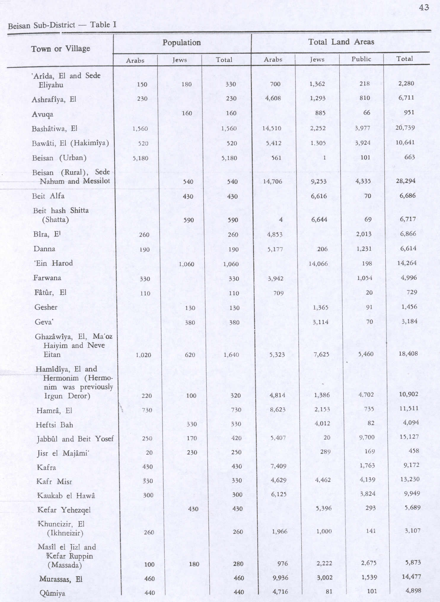
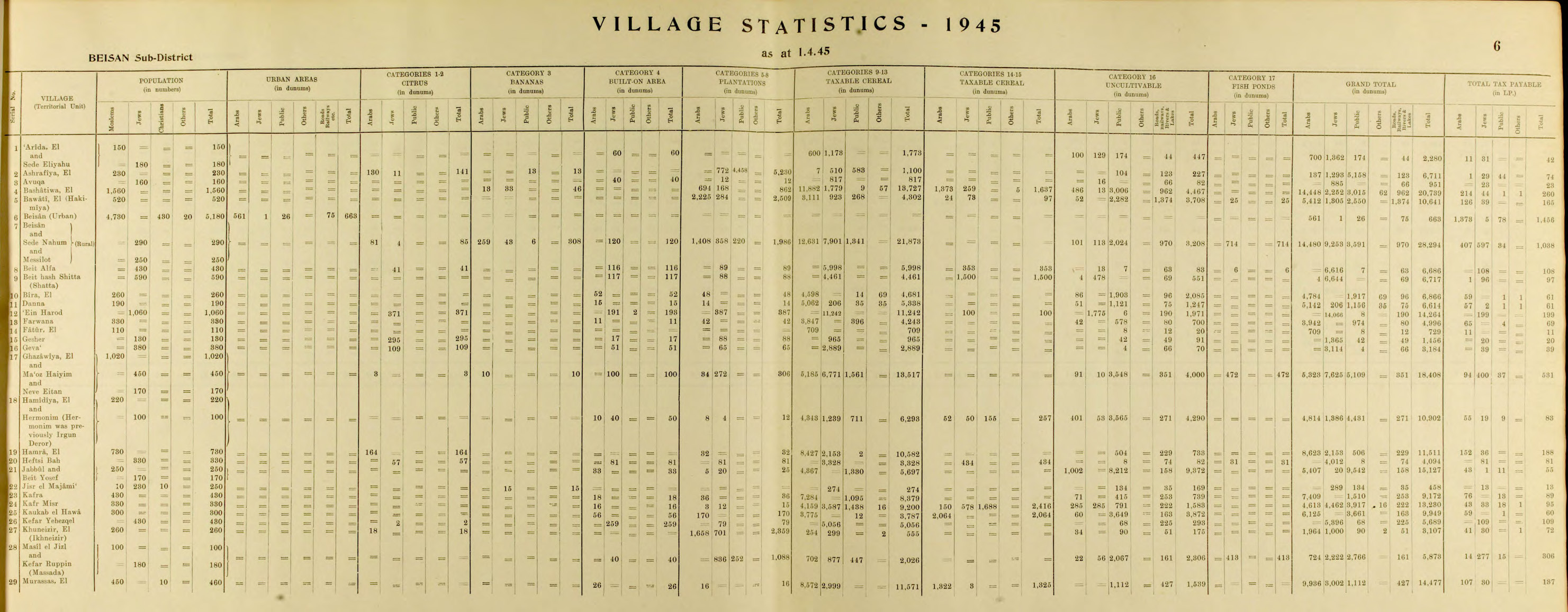
ENSIKLOPEDIA Cari Tekan Enter untuk memulai pencarian cepat. Kembali ke Ensiklopedia Arsip Wikipedia Indonesia Al-Fatur Al-FaturDesa in Baysan, Mandat PalestinaTemplat:SHORTDESC:Desa in Baysan, Mandat PalestinaAl-Fatur الفاتورDesaAl-FaturLokasi di Mandat PalestinaKoordinat: 32°23′55″N 35°31′36″E / 32.39861°N 35.52667°E / 32.39861; 35.52667Grid Palestina199/200Entitas geopolitikMandat PalestinaSubdistrikBaysanLuas[1] • Total729 dunams (72,9 ha or 180 acre)Populasi (1945) • Total110[1][2] Al-Fatur adalah sebuah desa Arab Palestina di Distrik Baysan. Desa tersebut dikosongkan dalam Perang Saudara Mandat Palestina 1947–1948 pada 12 Mei 1948. Desa tersebut berjarak 11.5 km dari selatan Baysan. Desa tersebut diserang oleh Pasukan Pertahanan Israel sebagai bagian dari Operasi Gideon. Referensi 1 2 Government of Palestine, Department of Statistics. Village Statistics, April, 1945. Quoted in Hadawi, 1970, p. 43 ↑ Government of Palestine, Department of Statistics, 1945, p. 6 Daftar pustaka Government of Palestine, Department of Statistics (1945). Village Statistics, April, 1945. Hadawi, S. (1970). Village Statistics of 1945: A Classification of Land and Area ownership in Palestine. Palestine Liberation Organization Research Center. Diarsipkan dari asli tanggal 2018-12-08. Diakses tanggal 2009-08-18. Khalidi, W. (1992). All That Remains:The Palestinian Villages Occupied and Depopulated by Israel in 1948. Washington D.C.: Institute for Palestine Studies. ISBN 0-88728-224-5. Mills, E., ed. (1932). Census of Palestine 1931. Population of Villages, Towns and Administrative Areas. Jerusalem: Government of Palestine. Pranala luar Welcome To al-Fatur al-Fatur, Zochrot Basis data pengawasan otoritas: Nasional Israel