Outline of BarbadosGeneral reference
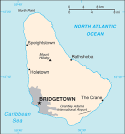 An enlargeable basic map of Barbados
 A highly detailed map of Barbados
Geography of Barbados
Geography of Barbados
Location of Barbados
- Barbados is located within the following regions:
- Extreme points of Barbados
- Northernmost point – North Point, Saint Lucy (N 13.334851, W -59.614742)
- Southernmost point – South Point, Christ Church (N 13.045294, W -59.526722)
- Easternmost point – Kitridge Point, Saint Philip (N 13.149207, W -59.420292)
- Westernmost point – Harrisons, Saint Lucy, Saint Lucy (N 13.305756, W -59.651022)
- High: Mount Hillaby 336 m (1,102 ft)
- Low: North Atlantic Ocean 0 m
- Land boundaries: none
Environment of Barbados
 An enlargeable satellite image of Barbados
Natural geographic features of Barbados
Regions of Barbados
Regions of Barbados
Ecoregions of Barbados
List of ecoregions in Barbados
Administrative divisions of Barbados
Municipalities of Barbados
History of Barbados
 African Slaves working in a sugar plantation in Barbados, 1807-1808
 Slaves Barbados march through the streets to celebrate their emancipation
History of Barbados
Culture of Barbados
Culture of Barbados
Arts and entertainment in Barbados
- Beauty pageants in Barbados
Sports in Barbados
Sports in Barbados
- Cricket in Barbados
- Cycling in Barbados
- Football in Barbados
- Netball in Barbados
- Rugby in Barbados
- Volleyball in Barbados
- Barbados at international sports competitions
- Other

.svg)


