Al-Burj, Ramle Al-Burj (bahasa Arab : البرج km dari timur Ramle yang dekat dengan jalan tol menuju Ramallah , yang dikosongkan pada 1948. Memiliki arti "menara", namanya diyakini berasal dari kastil salibis, Kastil Arnold, yang dibangun di tempat tersebut. Para pengunjung Victorian pada abad ke-19 tercatat menyaksikan reruntuhan pasukan salibis di dekat desa tersebut.[ 6]
Referensi
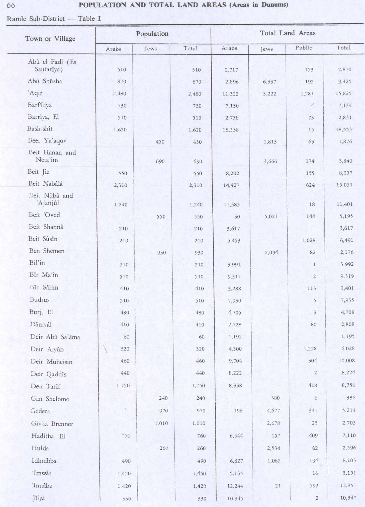
↑ Palmer, 1881, p. 292 ↑ Morris, 2004, p. xix village #236. Also gives cause of depopulation. ↑ Department of Statistics, 1945, p. 29 ↑ Government of Palestine, Department of Statistics. Village Statistics, April, 1945. Quoted in Hadawi, 1970, p. 66 Diarsipkan 2016-03-03 di Wayback Machine . ↑ Khalidi, 1992, p. 371 ↑ Khalidi, 1992, p. 371, referring to Robinson, 1841, vol 3, p. 57 ; and Conder and Kitchener, 1883, SWP III, p. 15
Daftar pustaka
Al-Amir, Kawthar (2002). Likay la tansi ha dati al-Burj [So my granddaughter doesn’t forget al-Burj] . Amman , Jordan: Dar ‘Alam al-Thaqafa. Pemeliharaan CS1: Lokasi tanpa penerbit (link ) Barron, J.B., ed. (1923). Palestine: Report and General Abstracts of the Census of 1922 Clermont-Ganneau, C.S. (1896). [ ARP] Archaeological Researches in Palestine 1873-1874, translated from the French by J. McFarlane 2. London: Palestine Exploration Fund.Conder, C.R. ; Kitchener, H.H. (1883). The Survey of Western Palestine: Memoirs of the Topography, Orography, Hydrography, and Archaeology 3. London: Committee of the Palestine Exploration Fund .Davis, Rochelle A. (2011). Palestinian Village Histories: Geographies of the Displaced Stanford University Press , Stanford, California. ISBN 978-0-8047-7312-6 Department of Statistics (1945). Village Statistics, April, 1945 Guérin, V. (1868). Description Géographique Historique et Archéologique de la Palestine 1: Judee, pt. 1. Paris: L'Imprimerie Nationale. Pemeliharaan CS1: Bahasa yang tidak diketahui (link ) Hadawi, S. (1970). Village Statistics of 1945: A Classification of Land and Area ownership in Palestine asli tanggal 2018-12-08. Diakses tanggal 2009-08-18 .Hartmann, M. (1883). "Die Ortschaftenliste des Liwa Jerusalem in dem türkischen Staatskalender für Syrien auf das Jahr 1288 der Flucht (1871)" . Zeitschrift des Deutschen Palästina-Vereins 6 : 102– 149.Khalidi, W. (1992). All That Remains: The Palestinian Villages Occupied and Depopulated by Israel in 1948 Washington D.C. : Institute for Palestine Studies . ISBN 0-88728-224-5 Mills, E., ed. (1932). Census of Palestine 1931. Population of Villages, Towns and Administrative Areas Morris, B. (2004). The Birth of the Palestinian Refugee Problem Revisited ISBN 978-0-521-00967-6 Palmer, E.H. (1881). The Survey of Western Palestine: Arabic and English Name Lists Collected During the Survey by Lieutenants Conder and Kitchener, R. E. Transliterated and Explained by E.H. Palmer Committee of the Palestine Exploration Fund .Pringle, Denys (1997). Secular buildings in the Crusader Kingdom of Jerusalem: an archaeological Gazetter Cambridge University Press . ISBN 0521 46010 7 Pringle, Denys (2009). The Churches of the Crusader Kingdom of Jerusalem: The cities of Acre and Tyre with Addenda and Corrigenda to Volumes I-III IV. Cambridge University Press . ISBN 978-0-521-85148-0 Robinson, E. ; Smith, E. (1841). Biblical Researches in Palestine, Mount Sinai and Arabia Petraea: A Journal of Travels in the year 1838 3. Boston: Crocker & Brewster .Socin, A. (1879). "Alphabetisches Verzeichniss von Ortschaften des Paschalik Jerusalem" . Zeitschrift des Deutschen Palästina-Vereins . 2 : 135– 163.